

Location intelligence software pulls together geospatial analytics, AI, and retail trade area data so you can make confident, profitable site selection decisions. Choosing the right platform isn’t just about heatmaps or scoring locations—it’s your safety net against network cannibalization, costly misses, and slow go-to-market. This guide goes deep on the best location intelligence software, with a focus on what actually lets retail leaders expand smarter and outpace the competition. You’ll see which tools deliver forecasting you can trust, Canada-readiness, and the features that protect your margins as you grow.
Why Trust Our Software Recommendations
6,700+
Reviews
20
Industry experts
16+
Evaluation factors
14
Years
Our team has been testing and reviewing software since 2012. As retail leaders ourselves, we know how difficult—and important—it is to choose the right software.
For this guide, we evaluated tools using hands-on testing and independent research, scoring tools using our selection criteria.
Our reviews reflect our independent judgment—not a sales pitch.
Location Intelligence Software Comparison Table
This comparison table summarizes pricing details for my top location intelligence software selections:
| Tool | Best For | Trial Info | Price | ||
|---|---|---|---|---|---|
| 1 | Best for cloud-native spatial site selection | 14-day free trial + free demo available | Pricing upon request | Website | |
| 2 | Best for retail site scoring and sales forecasting | Free demo + free trial available | Pricing upon request | Website | |
| 3 | Best for retail site selection and network planning | Free demo available | Pricing upon request | Website | |
| 4 | Best for behavior-based trade area intelligence | Free demo available | Pricing upon request | Website | |
| 5 | Best for Canadian retail site and trade area intel | Free demo available | Pricing upon request | Website | |
| 6 | Best for ML-driven retail site forecasting | Free plan available | From $16/user/month (billed annually) | Website | |
| 7 | Best for 48-hour site reads with no data upload | Free demo available | Pricing upon request | Website | |
| 8 | Best for AI-driven site forecasting and white space | Free demo available | Pricing upon request | Website | |
| 9 | Best for ensemble-model sales forecasting at scale | Free demo available | Pricing upon request | Website | |
| 10 | Best for foot traffic-driven site selection | Free plan + free demo available | Pricing upon request | Website |


Location Intelligence Software Reviews
Below are my detailed summaries of the best location intelligence software that made it onto my shortlist. My reviews offer a detailed look at the features, best use cases, and capabilities of each platform to help you find the best one for you.
 Best for cloud-native spatial site selection
- 14-day free trial + free demo available
- Pricing upon request
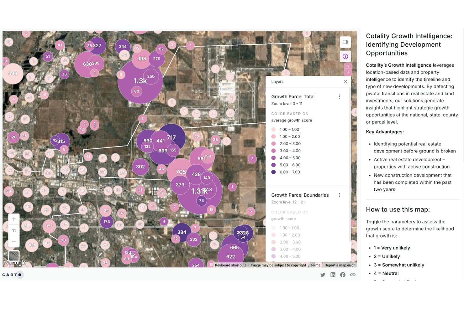
CARTO maps real estate growth scores to surface development opportunities. CARTO is a cloud-native spatial analytics platform that runs directly inside your data warehouse, offering geospatial mapping, trade area analysis, foot traffic data, site selection modeling, and competitive visualization.
Who Is CARTO Best For?
CARTO is a strong fit for enterprise retail and real estate teams that already run on cloud data warehouses like Snowflake or BigQuery and need spatial analytics to live inside that same infrastructure.
Why I Picked CARTO
I picked CARTO as one of the best because it's purpose-built to run spatial analytics directly inside your existing cloud data warehouse, with no ETL or data duplication. What I find genuinely useful for site selection is the combination of CARTO Builder's large-scale network visualization and the Data Observatory's 12,000+ curated datasets, including Mastercard transaction data and Unacast mobility feeds, for revenue prediction and whitespace analysis. I've used mobility-derived trade areas to compare actual customer catchments against drive-time polygons, which gives a far more accurate read on real coverage than radius rings alone.
CARTO Key Features
- AI Agents for spatial queries: Ask natural language questions about your spatial data and get instant map updates, layer additions, or site planning answers—no GIS expertise needed.
- CARTO Workflows: A drag-and-drop, low-code environment with 100+ components for building spatial analysis pipelines, including ML model import for predictive scoring.
- H3 hexagonal spatial indexing: Natively supported in Workflows for consistent, scalable spatial aggregation across large store networks.
- Origin-destination matrices: Map where customers travel from and to a given location using mobility provider data, revealing real movement patterns between sites.
CARTO Integrations
CARTO connects natively with Snowflake, Google BigQuery, Databricks, Amazon Redshift, Tableau, Power BI, and more.It also supports marketplace billing through Google Cloud, AWS, Microsoft Azure, and Snowflake.
Pros and Cons
Pros:
- AI agents enable natural language spatial queries
- Access to 12,000+ curated spatial datasets
- Runs spatial analytics inside your data warehouse
Cons:
- No off-the-shelf retail field tool
- Advanced analysis requires SQL or GIS expertise
Learn more about CARTO: Best for retail site scoring and sales forecasting
- Free demo + free trial available
- Pricing upon request
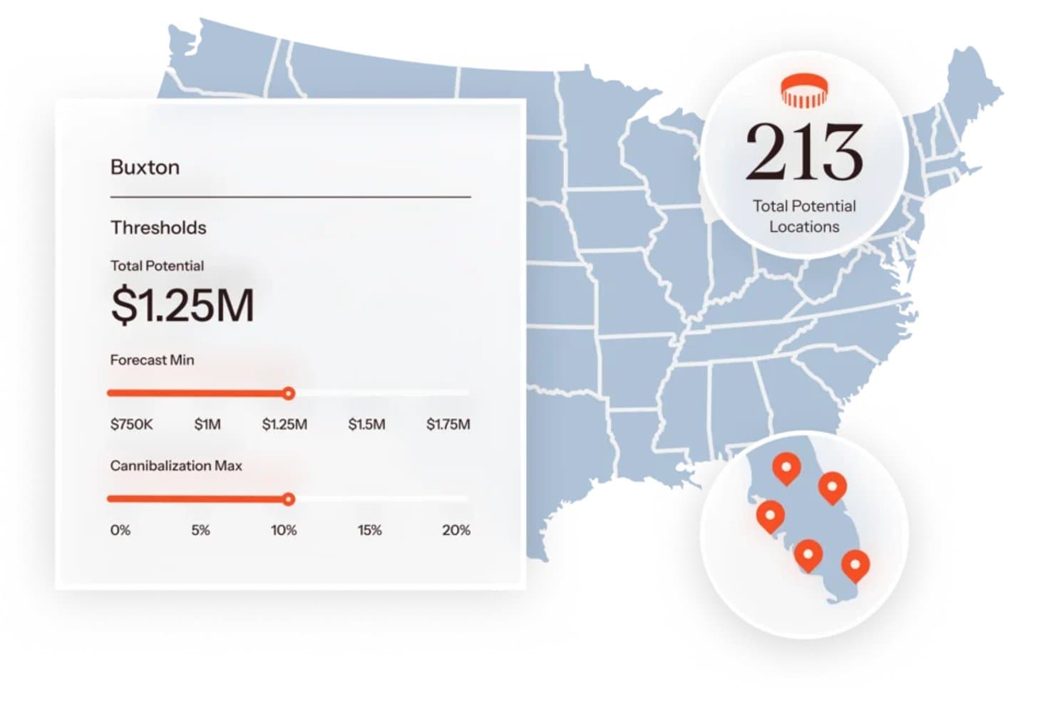
Audiense In-Person helps users find optimal store locations using revenue thresholds. Audiense In-Person is a location intelligence platform built on Buxton's 30-year site selection foundation, combining proprietary site scoring models, trade area analysis, foot traffic data, and whitespace discovery for multi-unit retail and franchise networks.
Who Is Audiense In-Person Best For?
Audiense In-Person is a strong fit for multi-unit retail and franchise networks that need custom site scoring models and revenue forecasting to guide expansion decisions.
Why I Picked Audiense In-Person
Audiense In-Person earns its spot on my shortlist because its site scoring and revenue forecasting models are built on 30 years of retail location data, not generic demographic indexes. I particularly like how SCOUT assigns each candidate site a numeric score calibrated against your existing store performance, so you're comparing real trade area conditions rather than abstract benchmarks. The Mobilytics module adds 44 billion mobile GPS data points to that picture, surfacing cross-shopping patterns that help validate whether a site's foot traffic actually matches your customer profile.
Audiense In-Person Key Features
- Mobilytics foot traffic analysis: Access 44 billion mobile GPS data points to track visitor trends by day, week, and year across retail points of interest.
- Whitespace discovery: Automatically identifies underserved markets where consumer demand exceeds current supply, surfacing expansion opportunities across your network.
- Portfolio optimization scoring: Compares each existing location's actual performance against its forecasted potential, flagging underperformers for close, relocate, or remodel decisions.
- Configurable reporting: Export trade area data, demographic profiles, and site analysis outputs as CSV or PDF for stakeholder presentations and custom downstream analysis.
Audiense In-Person Integrations
Audiense In-Person connects with Audiense Discover and Audiense Online/Elevar, plus MCP Connectors for Claude and ChatGPT.
Pros and Cons
Pros:
- Whitespace discovery for expansion opportunities
- Foot traffic analysis uses 44 billion GPS points
- Site scoring based on your real data
Cons:
- Models and data sources lack transparency
- Custom onboarding is slow to complete
Learn more about Audiense In-Person: Best for retail site selection and network planning
- Free demo available
- Pricing upon request
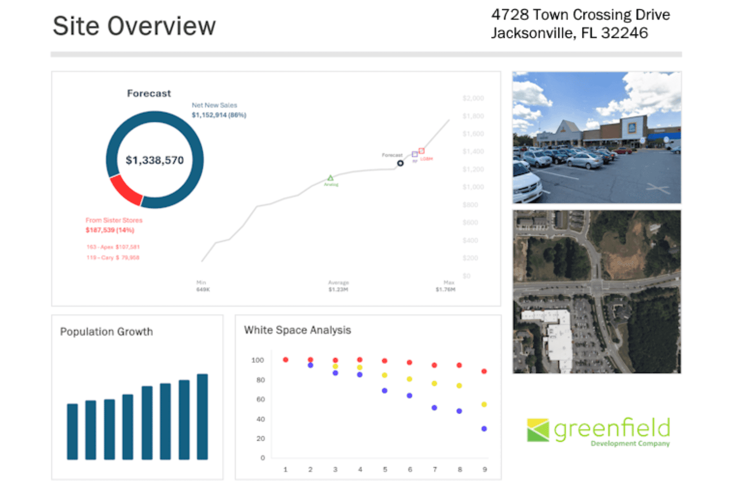
SiteSeer delivers sales forecasts and site analytics in one dashboard. SiteSeer is a retail-focused location intelligence platform that combines site selection modeling, trade area analysis, demographic data, foot traffic insights, competitive intelligence, and portfolio optimization into a single tool.
Who Is SiteSeer Best For?
SiteSeer is a strong fit for multi-unit retail real estate and network strategy teams who need a dedicated platform for site selection, trade area analysis, and portfolio optimization.
Why I Picked SiteSeer
SiteSeer earns its spot on my shortlist because it's built specifically for retail site selection in a way that generalist location intelligence tools simply aren't. I particularly like the combination of analog modeling and ML-based sales forecasting, which lets you benchmark candidate sites against existing top performers while layering in predictive revenue estimates. The Fit Trade Areas feature is also standout for me, because it derives catchment zones from actual foot traffic patterns rather than simple radius rings, giving you a much more accurate picture of who's actually shopping a given location.
SiteSeer Key Features
- Void analysis: Scores prospective tenants for vacant shopping center spaces using Match Score and Cotenant Score metrics to rank retailer fit by location compatibility.
- White space analysis: Scans geographies to surface markets where consumer demand outpaces existing retail supply, flagging expansion opportunities across your network.
- Portfolio optimization: Reviews your existing store network and scores each location on trade area strength, cannibalization exposure, and untapped market opportunity.
- On-demand demographic reports: Generates single-location demographic summary or detail reports in PDF and Excel formats without requiring a full platform subscription.
SiteSeer Integrations
Native integrations are not clearly documented. SiteSeer supports custom API configuration and system integrations through professional services, plus data connections with providers such as Precisely PlaceIQ, Azira, INRIX, and AGS.
Pros and Cons
Pros:
- Trade area analysis uses real shopper patterns
- Void analysis highlights leasing opportunities quickly
- Built for retail site selection workflows
Cons:
- Field data import functionality is restricted
- Limited coverage outside U.S. and Canada
Learn more about SiteSeer: Best for behavior-based trade area intelligence
- Free demo available
- Pricing upon request
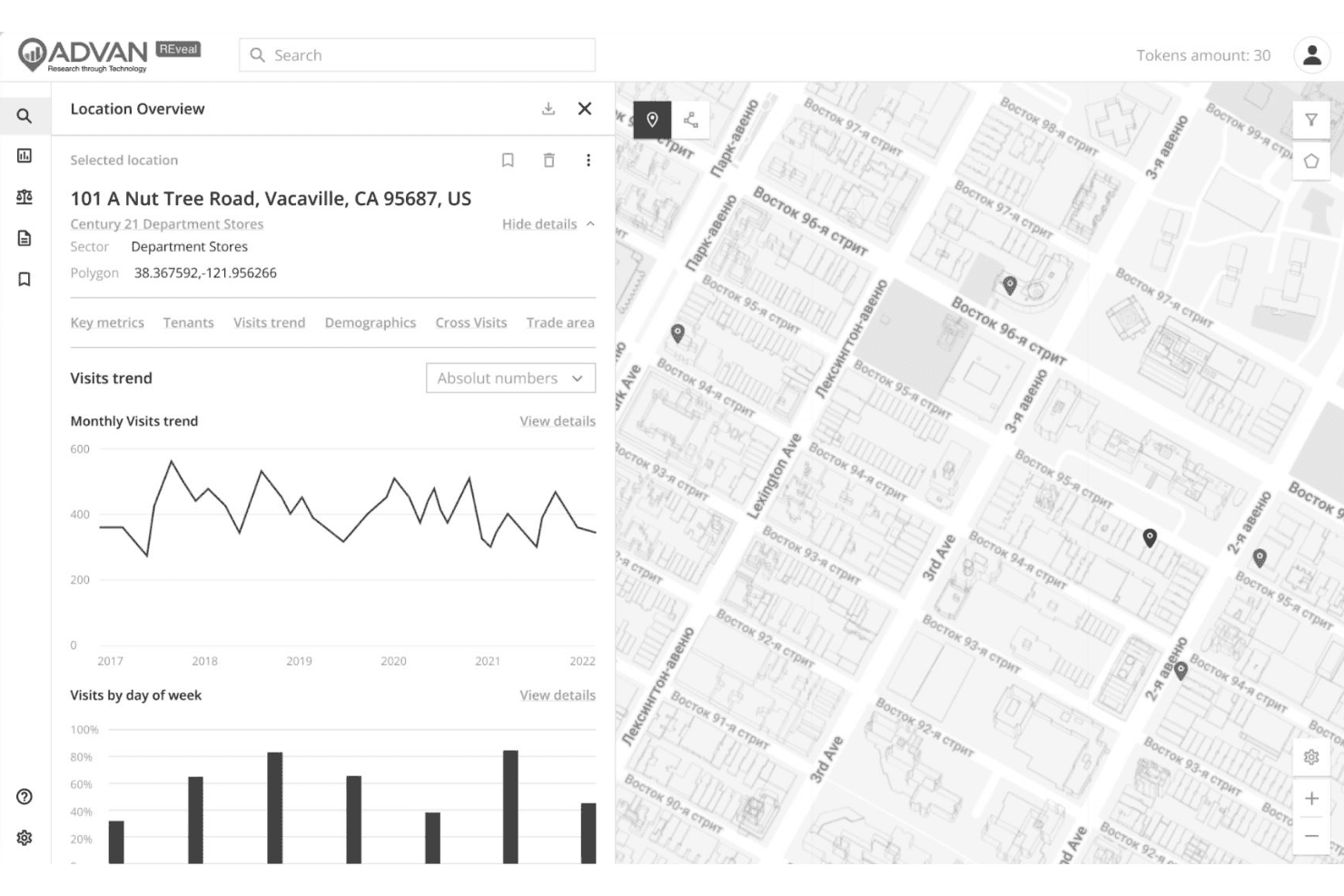
Advan reveals foot traffic trends for retail locations on an interactive map. Advan is a location intelligence platform built around behavior-derived foot traffic data, offering trade area analysis, mobility analytics, consumer spend intelligence, and competitive benchmarking across millions of points of interest.
Who Is Advan Best For?
Advan is a strong fit for analytically mature retail real estate and store network strategy teams that need behavior-derived trade area data to support site selection, cannibalization analysis, and portfolio decisions.
Why I Picked Advan
I picked Advan as one of the best because its trade areas are built from actual visitor origin data rather than static drive-time radii, which makes a real difference when you're trying to understand where customers are actually coming from. I love that you can draw a custom polygon over any geography in the REveal platform and immediately see visitor demographics, dwell time, and cannibalization overlap for that exact zone. The SpendView layer ties transaction data directly to foot traffic, so you can see whether a location's traffic actually converts to spend.
Advan Key Features
- SpendView transaction data: Access panel data from 120M+ cards and 40B+ transactions to track customer spend, channel split, and cross-brand shopping behavior across 5,000+ retailers.
- REPerspectives migration intelligence: Monitor net population in/out migration across states, metros, counties, and custom trade areas with monthly updates drawn from 6+ trillion mobile measurements.
- Complementary weather data overlay: Layer 20 years of daily historical weather observations across 10M+ POIs to normalize foot traffic and spend data for temperature and precipitation events.
- Scenario modeling for network planning: Simulate store opening, closure, and relocation scenarios across your full portfolio using ranked POI data, cannibalization scoring, and demographic fit assessment.
Advan Integrations
Native integrations are not clearly documented. Advan supports REST API access, FTP, AWS S3, Google Cloud, and CSV exports, while SpendView data connects within REI for combined traffic and spend analysis.
Pros and Cons
Pros:
- Combined transaction and mobility data analysis
- T+1 daily foot traffic data freshness
- Trade areas built from actual visitor origins
Cons:
- Limited executive dashboards for retail operations
- No dedicated retail sales forecasting module
Learn more about Advan: Best for Canadian retail site and trade area intel
- Free demo available
- Pricing upon request
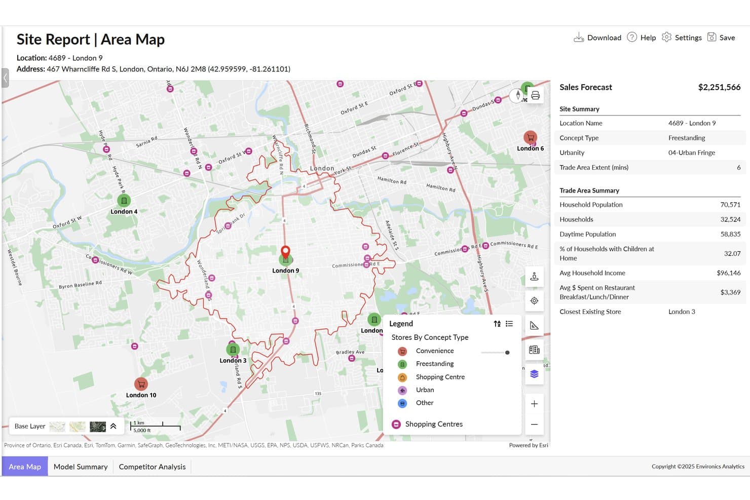
ENVISION lets users analyze trade areas and forecast sales by location. ENVISION is a cloud-based location intelligence platform by Environics Analytics that combines geospatial mapping, trade area analysis, mobility data, and geodemographic segmentation across 40,000+ Canadian and North American consumer variables.
Who Is ENVISION Best For?
ENVISION is a strong fit for Canadian retail and real estate teams who need deep geodemographic data, trade area analysis, and mobility intelligence to support site selection and network planning decisions.
Why I Picked ENVISION
ENVISION earns its spot on my shortlist because no other platform matches its depth of Canadian geodemographic data for retail site and trade area decisions. I love how the Retail Interaction Tool directly quantifies competitor overlap within any trade area, making cannibalization analysis concrete rather than theoretical. Paired with MobileScapes, which pulls daily-updated visitor movement data from cellular networks and ~100,000 mobile apps, you get a precise read on who's actually showing up to a location and where they're coming from.
ENVISION Key Features
- PRIZM segmentation: Access 67 Canadian and 68 U.S. lifestyle segments to profile customers and trade areas by demographics, values, and spending behavior.
- Consumer Buying Power database: Query potential annual consumer spending across 700+ household expenditure categories for any geographic area.
- Embedded AI Analyst: An AI layer that surfaces trends and audience insights directly from EA's proprietary datasets without manual data wrangling.
- Real-time collaboration: Multiple users can work inside the same dashboards and reports simultaneously, with changes visible across the team instantly.
ENVISION Integrations
ENVISION integrates with Esri ArcGIS Enterprise on Kubernetes, Microsoft Azure, Snowflake, and LiveRamp. It supports first-party data uploads and limited API access for custom integrations.
Pros and Cons
Pros:
- Retail Interaction Tool quantifies cannibalization risk
- MobileScapes provides daily updated mobility data
- Deepest Canadian geodemographic dataset available
Cons:
- Limited self-serve machine learning features
- No public user reviews or ratings
Learn more about ENVISION: Best for ML-driven retail site forecasting
- Free plan available
- From $16/user/month (billed annually)
Visit WebsiteCustomer Rating:4.8/5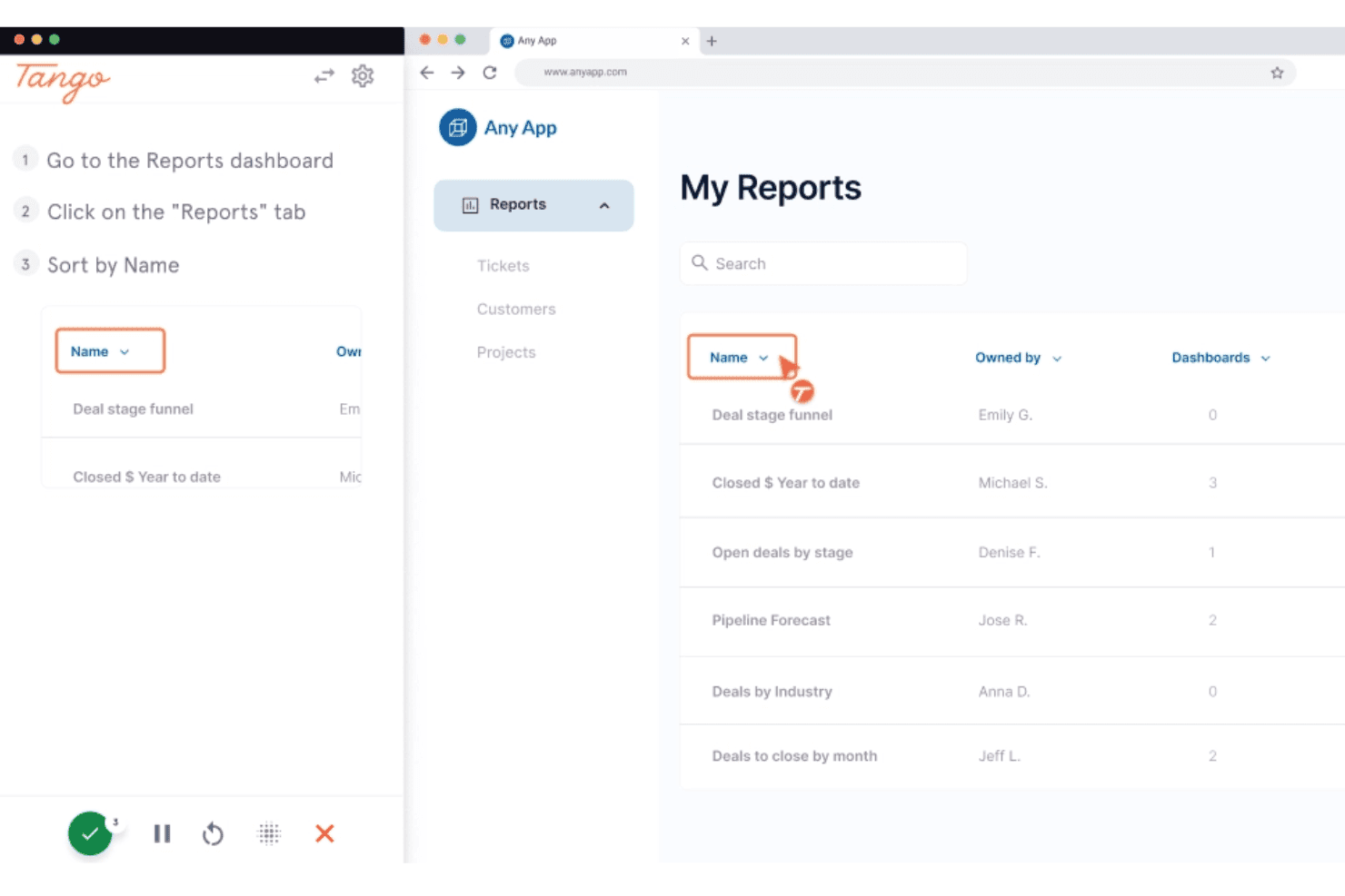
Tango captures step-by-step workflows directly in the browser. Tango Analytics is a retail location intelligence platform built around ML-driven site selection, trade area analysis, sales forecasting, competitive mapping, and portfolio health assessment for enterprise retail and restaurant chains.
Who Is Tango Best For?
Tango Analytics is built for enterprise retail and restaurant chains with large, complex store networks that need ML-driven site forecasting and portfolio rationalization tools backed by dedicated real estate teams.
Why I Picked Tango
I've included Tango in my top picks because its ML-driven site forecasting engine is genuinely category-leading. The platform runs 100+ algorithms and selects the optimal combination per client, producing sales forecasts calibrated against your actual portfolio data with claimed 40% accuracy improvements over traditional methods. I also like that those forecasts are fully explainable, so your real estate committee can interrogate the model outputs rather than just trust a black box.
Tango Key Features
- Foot traffic and vehicle data overlays: Pull pedestrian activity from Azira and vehicle flow from INRIX, filtered by time of day, day of week, or season, directly onto your site maps.
- Competitor geofencing: Draw geofences around rival locations to capture anonymized mobile traffic data and analyze cross-visitation and share-of-wallet patterns.
- White space discovery: Automatically identify geographies where demand outpaces current retail supply, surfacing unserved or underserved markets across your target regions.
- Ask TangoAI conversational interface: Query your portfolio data in plain English to pull site-level or market-level insights without needing technical GIS or data skills.
Tango Analytics Integrations
Tango Analytics offers built-in APIs and prebuilt connectors for enterprise data environments. It connects to data sources including Azira, Near, INRIX, ChainXY, Synergos Technologies, Applied Geographic, Green Street, and U.S. Census data.
Pros and Cons
Pros:
- Retail-specific demographic and mobility data overlays
- Built-in competitor geofencing and cannibalization modeling
- ML-driven revenue forecasts tailored to portfolio
Cons:
- Limited custom reporting across multiple regions
- Enterprise deployments require substantial time investment
Learn more about Tango: Best for 48-hour site reads with no data upload
- Free demo available
- Pricing upon request
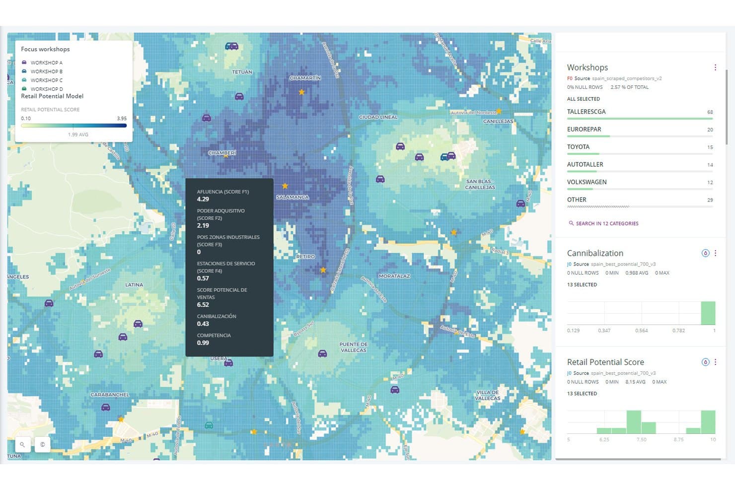
Locatium helps users score and map retail potential across city zones. Locatium is a location intelligence platform built for retail network planning, combining AI-driven site scoring, mobility-based trade area analysis, sales forecasting, competitive monitoring, and portfolio optimization across a single web-based interface.
Who Is Locatium Best For?
Locatium is a strong fit for retail real estate and network strategy teams that need fast, data-ready site reads without building internal data pipelines first.
Why I Picked Locatium
I've included Locatium in my top picks because it's the only location intelligence platform I know of that delivers a scored site analysis and sales forecast within 48 hours, with no client data upload required. You share target market boundaries, and Locatium's AI pulls from 500M+ daily mobility events to return ranked location scores and competitor context. I especially like the behavior-based catchment modeling, which uses real visitor movement and gravity models instead of static radius assumptions.
Locatium Key Features
- Network optimization module: Scores your existing store portfolio for close, relocate, or remodel decisions, and surfaces white space where demand exceeds current supply.
- What-if scenario modeling: Compares alternate network strategies with ROI projections at 12-, 24-, and 36-month horizons before committing to any site decision.
- Category recommendation engine: Delivers AI-driven product assortment guidance at the individual store level, drawing on local visitor demographics and competitive context.
- Role-based access control: Manages platform access across analyst, strategy, and executive stakeholders with configurable permissions and audit-ready, branded report exports.
Locatium Integrations
Native integrations are not clearly documented. Locatium connects to 120+ data streams through API-integrated sources.
Pros and Cons
Pros:
- Supports branded, audit-ready PDF exports
- Identifies cannibalization risk using live data
- Returns portfolio health scoring and ROI
Cons:
- Data provider sources are not disclosed
- No staffing optimization module included
Learn more about Locatium: Best for AI-driven site forecasting and white space
- Free demo available
- Pricing upon request
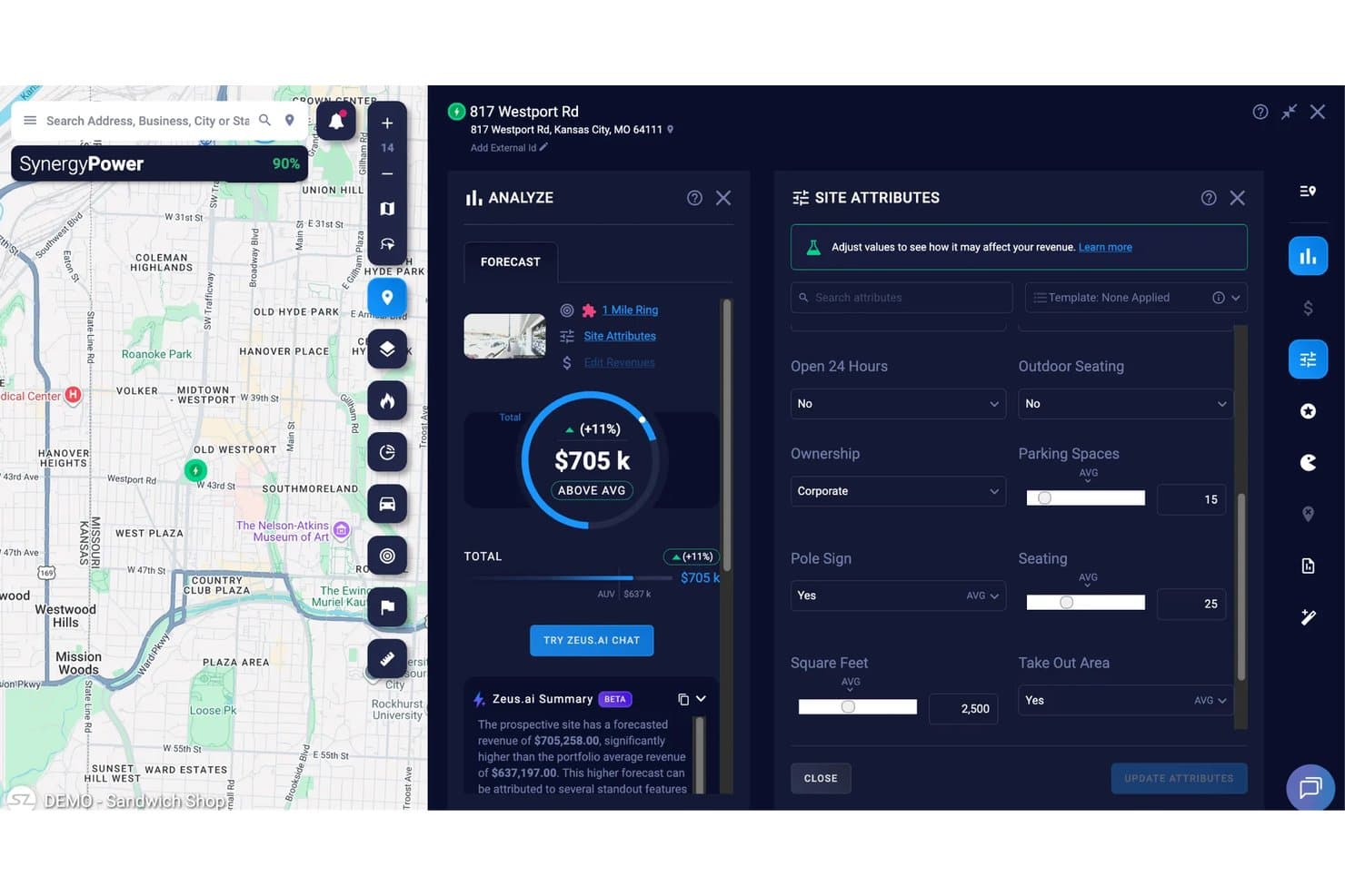
SiteZeus lets users adjust site attributes to forecast revenue impact. SiteZeus is a location intelligence platform built around AI-powered site selection, trade area analysis, white space discovery, and portfolio management for multi-unit retail and restaurant brands.
Who Is SiteZeus Best For?
SiteZeus is a strong fit for multi-unit restaurant and retail brands that need AI-powered sales forecasting and franchise network expansion tools in one platform.
Why I Picked SiteZeus
SiteZeus earns its spot on my shortlist because its AI forecasting goes beyond generic predictions—it trains models on your brand's own historical sales data to project revenue for candidate sites. I particularly like Site Sonar, which runs up to 50,000 sales projections across the U.S. and Canada in minutes, surfacing white space opportunities that manual analysis would never catch at that scale. Zeus.ai then explains each forecast in plain language, breaking down exactly which variables are driving the numbers.
SiteZeus Key Features
- Smart Comps: Identifies the closest analog locations from your own portfolio to benchmark a candidate site against your brand's real performance history.
- Custom A–F scorecards: Lets you build weighted scoring criteria so every site gets evaluated against the same configurable standards across markets.
- Sales Impact studies: Quantifies the percentage sales effect on nearby owned locations when you open a new site, using mobile data overlap analysis.
- Automated territory creation: Builds and rebalances franchise or corporate territories using transaction data and target demographic criteria as your network grows.
SiteZeus Integrations
SiteZeus doesn't have any native integrations clearly documented. It connects to REsimplifi for live real estate listings.
Pros and Cons
Pros:
- Cannibalization impact modeled using mobile data
- White space analysis runs 50,000 site projections
- AI forecasting trains on your brand’s data
Cons:
- Only U.S./Canada data coverage substantiated
- No publicly listed third-party app connectors
Learn more about SiteZeus: Best for ensemble-model sales forecasting at scale
- Free demo available
- Pricing upon request
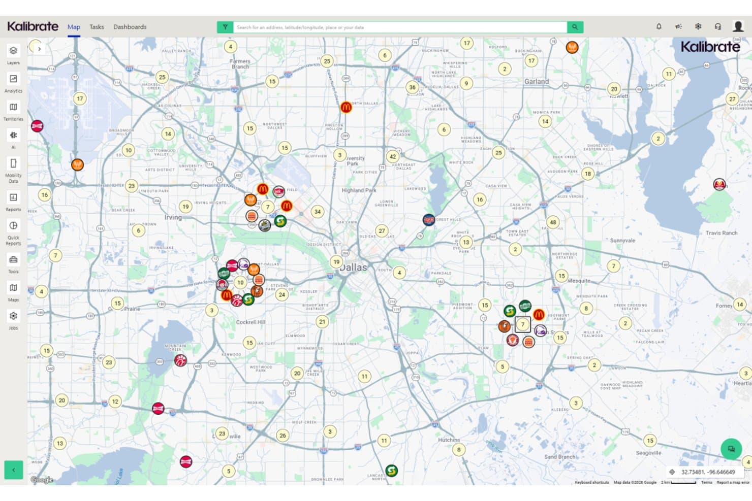
Kalibrate Location Intelligence maps competitor clusters across Dallas. Kalibrate Location Intelligence is a site selection and network planning platform that combines ensemble-model sales forecasting, trade area analysis, foot traffic data, competitive mapping, and whitespace discovery for retail and restaurant brands.
Who Is Kalibrate Location Intelligence Best For?
Kalibrate Location Intelligence is a strong fit for enterprise retail and restaurant brands running multi-site expansion programs that need statistically defensible revenue forecasts before committing to new locations.
Why I Picked Kalibrate Location Intelligence
I picked Kalibrate Location Intelligence because its Ensemble Modeling™ approach combines multiple predictive models rather than relying on a single one, producing first-year revenue forecasts that hold up under scrutiny at the site level and across an entire network. I also like the Model Forecast Explainer, which generates plain-language breakdowns of what's driving each forecast, so real estate and strategy teams can defend site decisions internally without needing a data science background.
Kalibrate Location Intelligence Key Features
- Competitive Insights module: Tracks foot traffic, dwell time, cross-shopping flows, and visitor demographics for competitor locations overlaid on your trade areas.
- Whitespace discovery: Scans markets automatically to surface underserved areas where your brand can expand without cannibalizing existing locations.
- Mobile field app: Lets your real estate team capture site photos, competitor observations, and geotagged notes on iOS or Android during market tours.
- Portfolio Analyzer: Flags market- and location-level performance gaps across your existing store network using competitor dashboards and opportunity scoring.
Kalibrate Location Intelligence Integrations
Native integrations are not clearly documented. Kalibrate Location Intelligence supports Excel imports, API access for custom data transfers and portfolio feeds, and data connections.
Pros and Cons
Pros:
- Provides quarterly demographic data refreshes
- Automates whitespace and cannibalization analysis
- Supports site tours with native mobile app
Cons:
- Detailed international data coverage is limited
- Website and documentation are frequently outdated
Learn more about Kalibrate Location Intelligence: Best for foot traffic-driven site selection
- Free plan + free demo available
- Pricing upon request
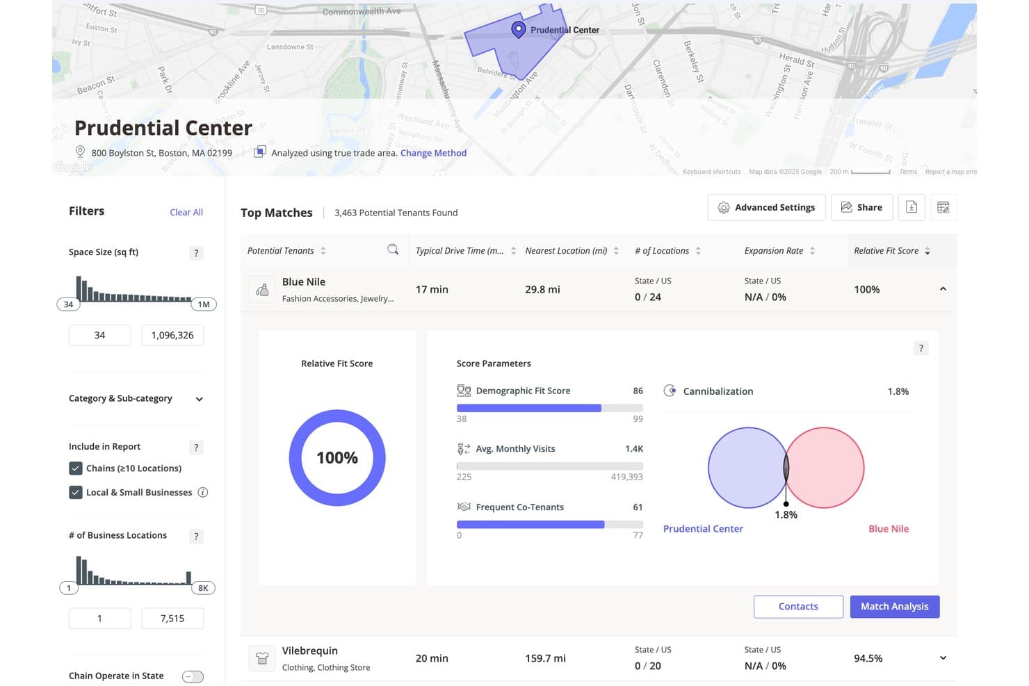
Placer.ai scores potential tenants by fit for a retail location. Placer.ai is a location intelligence platform built around foot traffic data, offering trade area analysis, site scoring, competitive benchmarking, and AI-enhanced retail sales estimation.
Who Is Placer.ai Best For?
Placer.ai is a strong fit for retail real estate directors and store network strategy teams who need behavior-based trade area data to guide site selection and portfolio decisions across the U.S.
Why I Picked Placer.ai
I've included Placer.ai in my top picks because its True Trade Area methodology is unlike anything else I've seen in this category—it derives catchment zones from actual visitor origin data rather than arbitrary radius rings, which makes site scoring far more defensible. I also rely on the Retail Sales Report, which combines foot traffic with transaction data to generate store-level revenue estimates without needing direct access to tenant sales figures. The cannibalization scoring feature quantifies visitor overlap between existing and candidate locations, so you can catch portfolio risk before signing a lease.
Placer.ai Key Features
- Visitor origin-destination analysis: Tracks where visitors travel from and where they go after visiting a location, using anonymized mobile device data.
- Cross-visitation reporting: Identifies which other brands and locations your visitors frequent, supporting co-tenancy and competitive positioning decisions.
- Chain benchmarking: Compares visit counts, dwell time, and visit frequency across named competitor chains at local, regional, or national levels.
- XTRA predictive analytics: Uses machine learning to forecast future foot traffic trends, including potential store closures and visit surges at specific locations.
Placer.ai Integrations
Placer.ai integrates with Esri ArcGIS and Snowflake Marketplace, and its API supports custom connections to internal dashboards, BI tools, POS data, and CRM data.
Pros and Cons
Pros:
- AI-powered retail sales estimation by location
- Detailed cross-shopping and chain benchmarking data
- True Trade Area catchment zones for stores
Cons:
- No built-in merchandising or workforce modules
- United States data only, no global coverage
Learn more about Placer.ai:
Other Location Intelligence Software
Here are some additional location intelligence software options that didn’t make it onto my shortlist, but are still worth checking out:
- 11PiinpointBest for network cannibalization and site scoring
- 12MApZot.AIBest for AI-driven site scoring and sales forecasts
- 13MaptitudeBest for Huff model trade area and market share
- 14UnacastBest for mobility-data-led site selection
- 15GrowthFactorBest for transparent, glass-box site scoring
- 16PassByBest for multi-signal foot traffic and spend intel
- 17GeoblinkBest for European retail expansion and site forecasting
- 18MytrafficBest for proprietary EU footfall and site forecasting
- 19AziraBest for multi-source mobility and trade area intel
- 20HuqBest for opt-in mobility and spend catchment data
How I Evaluate Location Intelligence Software
When a real estate director needs to score 50 candidate sites before a board meeting, the tools that make my list have to clear two bars: core functionality every serious platform must deliver, and the differentiators that separate a shortlist contender from the rest.
Core Functionality (Table Stakes For This List)
When I'm selecting tools for my list, I rank each one on a scale from 0 (does not offer the functionality) to 5 (excels in this area) for each core functionality listed below. I then calculate the tool's total score into a percentage, using 65% as a benchmark to help assess its overall fit for the list.
- Geospatial mapping & visualization: I check whether the platform renders interactive, multi-layer maps that let you overlay trade areas, demographics, and competitor pins without losing performance as you zoom in.
- Demographic & consumer data: The depth and freshness of built-in datasets matter here, from income and psychographic segments to spending patterns tied to specific geographies.
- Trade area analysis: I evaluate how many methods a tool supports for defining catchment zones, whether that's drive-time polygons, custom boundaries, or gravity and Huff models that reflect real shopping behavior.
- Foot traffic & mobility data: Platforms should surface visitation counts, dwell time, and visitor origin data so you can validate a candidate site against actual movement patterns rather than estimates alone.
- Site selection modeling: I look for predictive scoring or revenue forecasting that goes beyond a basic checklist, including what-if scenarios and network-level optimization for multi-site expansion plans.
- Competitive & cannibalization analysis: A tool earns points here when it maps competitor locations and quantifies overlap between your own stores, helping you spot white space and avoid splitting sales across nearby sites.
Once I have a list of tools that meet the criteria, I consider what sets each platform apart.
Differentiating Factors (What Sets Vendors Apart)
Here's how I compare and contrast different vendors:
Standout Features
I look for white space discovery that automatically flags underserved markets where demand outpaces supply, since manually screening hundreds of geographies slows down expansion cycles. Sales forecasting models matter just as much—I evaluate whether a platform combines analog store performance with demographics and traffic to predict first-year revenue, not just rank sites. Portfolio health dashboards round out my check; when you're deciding whether to close, relocate, or remodel existing stores, a single view scoring each location on cannibalization exposure and trade area strength saves weeks of analysis.
Beyond Features
I evaluate how fresh a platform's mobility and demographic data actually are, since a site scored on year-old foot traffic can mislead a board presentation. Equally important is how well a tool connects to your existing POS, CRM, or BI stack—if you can't overlay real sales data on a trade area map, you're forecasting in a vacuum. I also check whether non-GIS users like real estate directors and merchandisers can self-serve without analyst hand-holding, because adoption beyond one power user determines long-term ROI.
How to Choose a Location Intelligence Software
When picking location intelligence software, ask yourself: which features will actually help you select, score, and manage your retail sites with real confidence—not just generate generic heatmaps?
| If your priority is... | Look for... |
|---|---|
| If your priority is...Rapid site analysis without uploading internal data | Look for...Tools with instant, out-of-the-box reports or public datasets |
| If your priority is...Minimizing network cannibalization | Look for...Built-in models for overlap and trade area impact |
| If your priority is...Reliable sales forecasting | Look for...Platforms with store analogs plus real demographic and mobility data |
| If your priority is...Canada-specific market planning | Look for...Canadian trade area data and regulatory overlays |
| If your priority is...Fast rollouts to new users | Look for...Interfaces designed for non-GIS users and simple onboarding |
How to Vet Your Shortlist
- Request a live demo using your real locations: See a multi-site scenario and ask for a trade area/cannibalization map output within 48 hours.
- Ask for a data freshness statement: Get documentation specifying the last update date for third-party foot traffic and demographic datasets.
- Test ease of use with a 1-hour trial task: Give a planner or merchandiser a candidate site list and check if they can generate rankings and footfall metrics with no analyst support.
- Verify integration with BI/POS systems: Request a named case study or document showing live link to sales data (not manual imports).
- Tradeoff—flexibility vs. speed: Decide whether you need point-and-click automation (speed) or custom GIS modeling support (flexibility), since most vendors won’t offer both at their best.
What Is Location Intelligence Software?
Location intelligence software is an analytics platform that combines geospatial data, demographic information, and mobility patterns to help retailers make informed site selection decisions. Using geographic information system capabilities, these tools visualize trade areas, predict sales, analyze customer movement, and map competitors. Location intelligence software can also support resource allocation by helping teams determine where stores, staff, and investments are most likely to perform well. This helps retail professionals identify expansion opportunities, forecast site performance, and reduce risks such as market overlap and cannibalization.
Features of Location Intelligence Software
When selecting location intelligence software, keep an eye out for the following key features:
- Geospatial mapping and visualization: Interactive maps combine geographic data with business information, helping you visualize site locations, trade areas, demographic overlays, and competitor activity. This brings GIS technology and data visualization into everyday location analysis.
- Demographic and consumer data: Access datasets covering age, income, education, population density, and consumer behavior to profile trade areas, understand market trends, and evaluate potential locations.
- Trade area analysis: Define catchment zones using drive-time rings, distance polygons, or custom boundaries. This feature helps you understand the real neighborhood of each site and compare performance across locations.
- Foot traffic and mobility insights: Analyze visitation counts, dwell times, and visitor origins to generate location-based insights and validate sites using real-world movement patterns.
- Site selection modeling: Combine business data, demographics, mobility patterns, and existing location performance to rank potential sites and support more informed market analysis.
- Competitive analysis tools: Map out the locations of direct competitors and identify proximity risks or white space opportunities so you can protect market share and minimize cannibalization.
- Network optimization: Model your entire store portfolio to find weak spots, relocation opportunities, or places where store density could split sales, giving you a portfolio-wide view.
- Integration with external systems: Use data integration with POS, CRM, business intelligence, and other systems to combine location analytics with current customer and sales data.
- Easy reporting and exports: Generate site reports, visual maps, and data tables you can share with decision makers or import into other business systems without extra wrangling.
- User-friendly interface: Enable non-technical users like real estate directors and merchandisers to conduct analyses without relying on GIS specialists, supporting broader adoption and faster decision making.
Common Location Intelligence Software AI Features
Beyond the standard location intelligence software features listed above, many of these solutions are incorporating AI with features like:
- Automated site scoring: AI models analyze historical sales, demographic shifts, and mobility data to generate predictive scores for new locations. This helps you quickly identify high-potential sites without manual data crunching.
- Demand forecasting: AI algorithms project future customer demand at specific sites using historical performance, seasonality, demographic changes, and local market trends.
- Anomaly detection: AI scans for unusual patterns in foot traffic, sales, or customer movement, flagging outliers that could signal emerging risks or opportunities. This lets you react faster to unexpected changes in the market.
- Natural language queries: AI-powered interfaces let users ask questions about locations, trade areas, and sales territories in plain language, making geographic analysis more accessible.
- Automated competitor monitoring: AI continuously tracks competitor openings, closures, and expansions, updating your maps and models in real time so you can adjust your strategy as the market shifts.
Benefits of Location Intelligence Software
Implementing location intelligence software provides several benefits for your team and your business. Here are a few you can look forward to:
- Faster site selection decisions: Location analytics, geospatial mapping, and automated scoring help you compare candidate locations and identify promising opportunities faster.
- Stronger sales and demand forecasts: Predictive modeling combines store analogs, demographic trends, and current mobility data to project first-year sales more reliably than manual analysis.
- Deeper competitive insights: Competitive mapping tools show where your rivals and existing stores overlap, so you can spot white space opportunities or avoid cannibalization in your network.
- Accurate trade area analysis: Built-in tools for drive-time, distance polygons, and custom catchment models let you define and compare real-world neighborhoods for every potential site.
- Real-time foot traffic validation: Access to current footfall and visitor origin data means you can evaluate locations using actual movement patterns—rather than just estimates or stale datasets.
- Portfolio optimization: Network-level dashboards help you identify underperforming stores, relocation candidates, or overserved regions, giving you a high-level view for smarter portfolio management.
- Greater accessibility for non-technical users: User-friendly location intelligence solutions make sophisticated geographic analysis available without requiring extensive GIS expertise.
Costs and Pricing of Location Intelligence Software
Selecting location intelligence software requires an understanding of the various pricing models and plans available. Costs vary based on features, team size, add-ons, and more. The table below summarizes common plans, their average prices, and typical features included in location intelligence software solutions:
Plan Comparison Table for Location Intelligence Software
| Plan Type | Average Price | Common Features |
|---|---|---|
| Plan TypeFree Plan | Average Price$0 | Common FeaturesBasic geospatial mapping, limited public datasets, restricted reporting, and support for a single user. |
| Plan TypePersonal Plan | Average Price$50–$200/user/month | Common FeaturesInteractive mapping, simple trade area analysis, access to core demographic data, and email support. |
| Plan TypeBusiness Plan | Average Price$300–$800/user/month | Common FeaturesAdvanced trade area modeling, foot traffic analytics, custom export options, team sharing, and standard support. |
| Plan TypeEnterprise Plan | Average Price$1,000–$5,000+/month | Common FeaturesPredictive site selection, API integrations, portfolio dashboards, custom datasets, dedicated onboarding, and priority support. |
Location Intelligence Software FAQs
Here are some answers to common questions about location intelligence software:
How accurate is the data in location intelligence software?
Accuracy depends on the source and freshness of the underlying datasets. Most leading platforms update foot traffic and demographic data regularly—some even provide a documented freshness statement. Asking vendors how often their data gets updated is important if you’re using the tool for board-level decisions or fast-changing markets.
Can location intelligence software integrate with my existing POS or CRM systems?
Yes, many platforms offer integrations for POS and CRM tools, but the depth of these integrations varies widely. Some allow real-time data syncs, letting you overlay live sales with trade areas, while others require manual imports. Always ask for a working demo or a specific case study to see real integrations in action.
Do I need a GIS background to use location intelligence software?
No, most modern tools are designed for non-technical users like real estate directors, merchandisers, and marketers. User-friendly interfaces and guided workflows let you run analyses and export site reports without any GIS skills. However, more advanced analyses (like custom modeling) might require some technical support.
How do these tools help with competitive and cannibalization analysis?
Location intelligence software maps competitor locations and your own stores, showing overlap and potential sales cannibalization. Some solutions use predictive models to help you quantify how a new opening might impact existing stores or market share, which helps you make more confident siting decisions.
What’s the best way to vet a location intelligence platform before buying?
Start by requesting a live demo using your actual store locations and candidate site list. Ask for a trade area or cannibalization map delivered within 48 hours, and check if a planner or merchandiser can complete a trial task with minimal training. Finally, ask for a detailed breakdown of data freshness and integration capabilities to make sure the software fits your workflow.